Day 13 (July 14th): Adirondacks and Lake George

Starting Point:  Thousand Island, NY

Ending Point:  Lake George, NY

Distance Traveled:  250 miles

Today, I started driving through the Adirondacks through Holly’s suggested route of Ogdensburg, Lake Placid, and down to Lake George.  Contrary to my expectations, the route was much more populated than I was expecting.  Every few miles the highway was dotted with a homes, shops, gas stations, and small restaurants.  It’s possible that just this route was populated because it passes through Lake Placid, the largest city in the Adirondacks.  Also, I didn’t see any trailhead markers or signs leading to recreation areas/campgrounds, which was surprising.

Screen Shot 2015-07-14 at 4.18.20 PM

My first stop was Lake Placid, a large area with a summer population of about 10,000 and a winter population of about 700. The area is beautiful with a Main Street stretching several miles, many oceanfront homes, and many hotels.  I stopped by a real estate office on the main street and asked him about how the area would work for a real estate investor.  He explained that the entire city is located in a State Park and property taxes are about 2-3%/year.  Therefore, operating a home as a vacation rental would most likely not turn a profit.  Also, commercial in this area is tricky, because stores are only busy in the summer months. This might provide an opportunity to buy residential/commercial properties at attractive prices, but I think since I live out-of-state, these concerns make this area a non-starter investing-wise.

IMG_1421

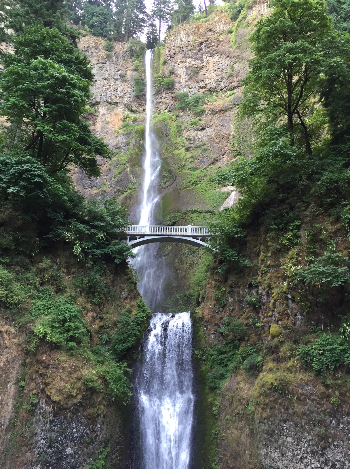
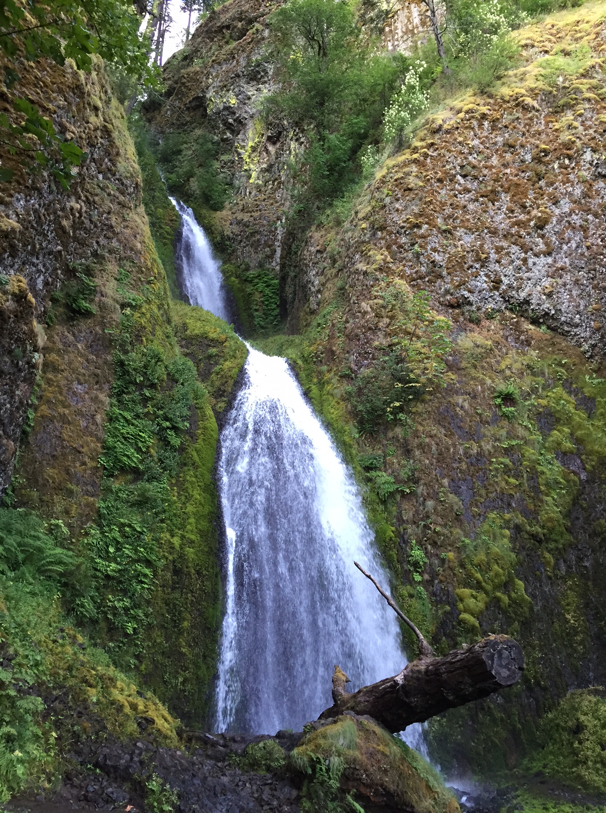
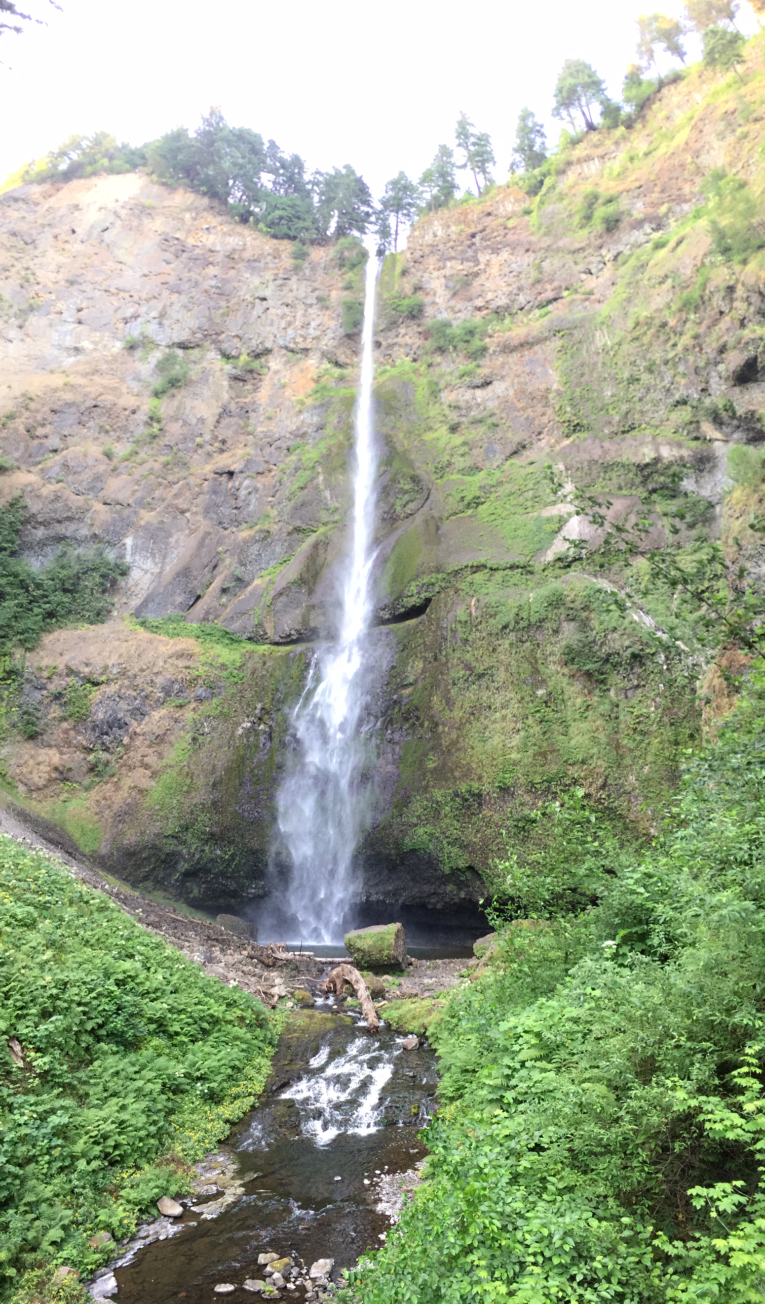
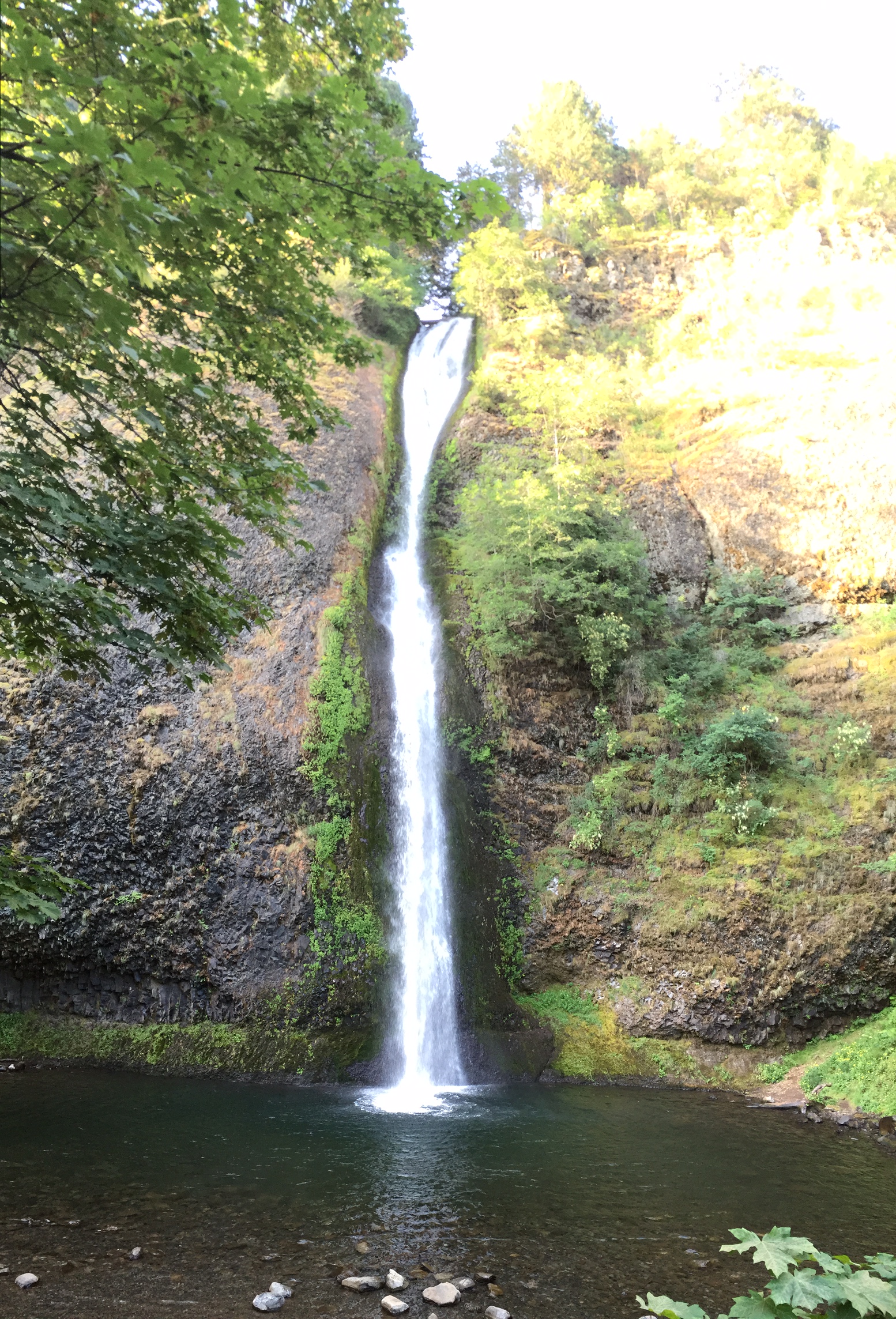
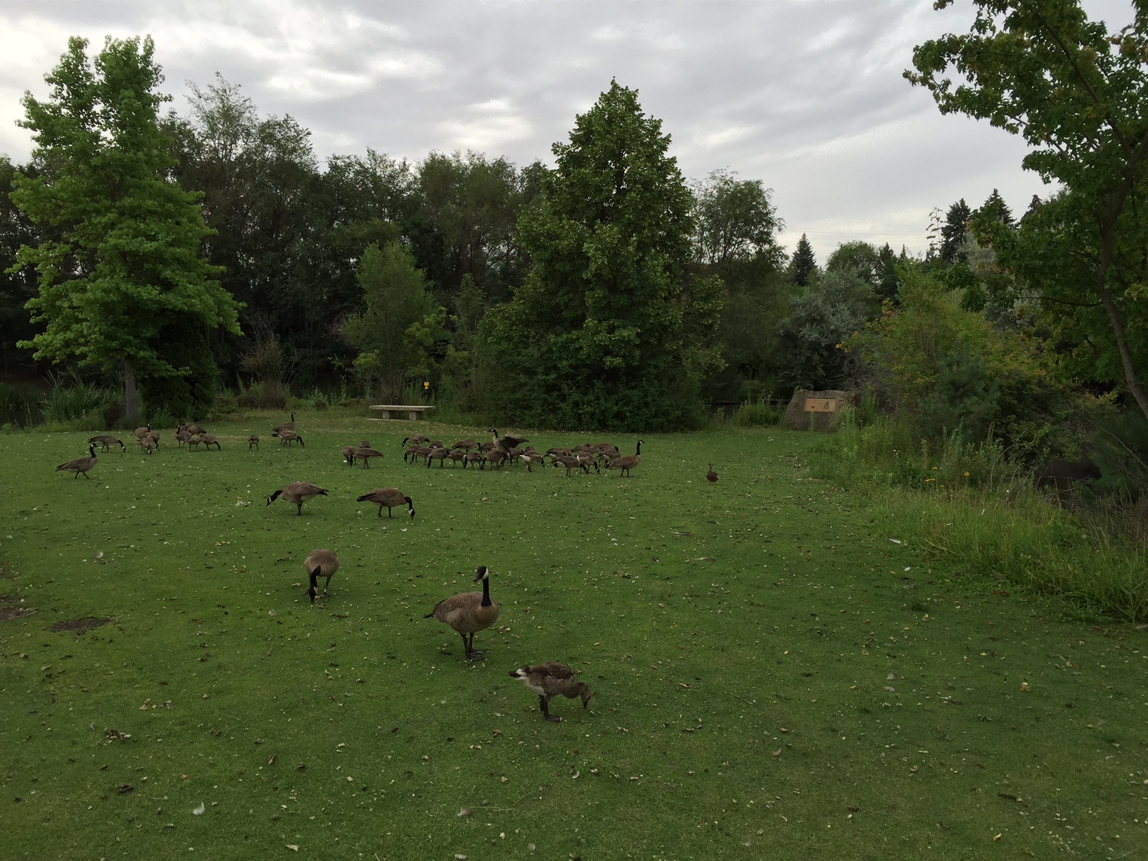
After Lake Placid, I was driving and few girls in bathing suits walking out of the forest toward a row of cars parked along the road.  I made a U-Turn and asked where the swimming area and/or hiking trail was.  After being told the location, I walked about five minutes and reached a quiet waterfall area with a large pool of water.  I jumped into the water several times, briefly went swimming, and left shortly thereafter.

IMG_1422 IMG_1423

After swimming, I drove to Lake George, NY, city at the edge of the Adirondacks that has a nice Downtown Area and beach area.  In the Lake George area, there’s a large real estate development company named Schermerhorn Real Estate Holdings. (http://www.schermerhornholdings.com/) SREH began flipping homes, then began developing apartment communities in the Glen Falls area and surrounding communities.  His strategy seems to be building new construction and holding indefinitely.  This strategy is very successful AND VERY LOW-RISK and can lead to long-term enormous wealth, but it just seems monotonous and boring.  I’m not sure I’d be willing to do this as a career, but why not?  If my main goal is to make money in a risk-free method, why not develop apartment communities and hold for the long-term?  Why not buy existing apartment communities and hold for the long-term?  Why should I acquire commercial properties with much higher risk, be concerned with the risk of vacancy, functional obsolescence, greater risk from external economic factors, needing to buy/sell/buy/sell, etc?  Why not just hold and have piece of mind?

My main goal in real estate is to add value to properties in the lowest risk/greatest upside method possible.  With residential, it’s very difficult to get the returns we’re currently getting.  Over the past three years, we’ve been making exceptional returns that we wouldn’t be able to make in the highly-competitive residential market.  I should be open to the idea of development down-the-line, but for now it’s too high risk in my current financial situation.  The short-term “lowest risk/greatest upside” analysis doesn’t pencil out for development right now, but maybe in 5-10 years it will begin to make sense.  The benefits of development are:

  • Creating your own opportunities, not as much competition
  • Exceptionally high returns if done right, and cash out after completion
  • At the end of the day, you own a brand new property with no problems or hair
  • Work is much more challenging/multi-faceted than value-add
  • Work is rewarding and you’re undeniably helping the community (creating living spaces, jobs, progress)

Maybe down the line, I can slowly progress to more challenging forms of real estate investment such as renovations, tenant improvements, repositioning (changing use of property), and eventually new development.  I should continuously weight be risk/rewards of development while taking into account my personal financial situation and eventually I can see myself engaging in some form of development if it pencils out.

Day 12 (July 13th): Thousand Island, NY

Starting Point:  Niagara Falls, NY

Ending Point:  Thousand Island, NY

Distance Traveled:  300 Miles

Last night, after spending a few hours at Starbucks in Niagara Falls I decided it wasn’t worth it to reserve a hotel for only 5 hours. I just proceeded to drive toward Rochester, NY and after about an hour I pulled over to a rest stop and slept for five hours.

At about 5AM, I awoke at the rest stop and continued driving toward Syracuse and then toward 1000 Islands, a scenic river area that separates Canada and the United States. The river area includes about 1800 islands, ranging from small outcrops in the ocean to 40 square mile islands. An island is defined as a mass of land that’s fully exposed throughout the entire year, has at least one tree on it and one other kind of vegetation, and is at least three feet in diameter. The islands throughout the area and mostly privately owned and house anything from grand estates, mobile homes, cottages, memorials, nature reserves, and more. Many of the islands has an interesting history dating back to as far back as the 1800s.

At 10AM, I went on a “Two Nations” Cruise with Uncle Sam’s in Alexandria Bay. (Uncle Sam’s Link) The “Two Nations Tour” takes guests on a 2.25-hour boat ride through the Canadian and USA parts of the 1000 Islands. The tour guide provided a lively narrative, complete with backgrounds of the islands, humor, and stories. We learned interesting facts such as the utilities service, waste disposal, access during winter, and more.

IMG_1311

IMG_1312

IMG_1315

IMG_1316

IMG_1318

IMG_1320

IMG_1323

IMG_1324

IMG_1326

IMG_1327

IMG_1330

IMG_1331

IMG_1332

IMG_1333

IMG_1335

IMG_1337

IMG_1338

IMG_1339

IMG_1340

IMG_1342

IMG_1343

IMG_1344

IMG_1345

IMG_1346

IMG_1348

IMG_1349

IMG_1351

IMG_1354 IMG_1355

IMG_1356

IMG_1358

IMG_1360

IMG_1362

IMG_1363

IMG_1365

IMG_1367

IMG_1369

IMG_1370

IMG_1371

IMG_1372

IMG_1373

At the end of the tour, we had the option of being dropped off at Boldt Castle, an enormous, unfinished castle of at least 30,000 SF that was built by a wealthy man as a token of love for his wife. The island is shaped as a heart, a sentimental shape for the man and his wife. Unfortunately, shortly before completion the man’s wife passed away and he was devastated. Him and his family both vowed to never set foot on the Island, and the home was eventually deeded to a public entity for use a museum.

IMG_1377

IMG_1378

IMG_1379

IMG_1380

IMG_1381

IMG_1382

IMG_1383

IMG_1384

IMG_1385

IMG_1386

IMG_1389

IMG_1390

IMG_1392

IMG_1393

IMG_1394

IMG_1395

IMG_1396

After the tour, I drove to Wellesley State Park, a 40-square-mile island located on one of the largest of the 1800 islands. After checking into a campsite, I drove to the Nature Center in the State Park and hiked a couple of miles through the bright green, lush landscape. The trail I hiked on was also marked as a backcountry ski trail for use during the winter.

IMG_1397

IMG_1399

IMG_1403

IMG_1404

IMG_1405

Afterwards, I drove to Thousand Islands Village (AKA “TI Village), a privately owned village encompassing a large part of Wellesley Island. According to the residents, in 1875, TI Village was leased out to the residents on a 99-year ground lease and all the homes are privately owned. The land-lease payments are made in the form of high property taxes (up to $18,000 according to Holly at Boomerang Canvas). This “corporation” was incredibly smart, especially now looking at the surrounding estates worth tens of millions of dollars.

In TI Village, I visited the docks and rented a kayak for a 1.5-hour trip through the narrows and around Mosquito Island. Jumping into the river immediately before kayaking definitely helped keep me cool during the warm kayaking trip.

Holly, the owner of Boomerang Canvas and serial entrepreneur simultaneously is a schoolteacher, café owner, rents sporting equipment, and sews canvas on the docks! I guess if you want to live in TI Village, you need to be creative and open-minded. The owner of the kayaking rental business, Holly, has been visiting TI Village during the summer since she was a teenager. As a teenager, she met her husband on the Island and now lives there and will likely plan on retiring there soon. Holly has an adorable fluffy black dog that’s 9 months old, and being trained to be a “dock dog,” or friendly dog spending time around the docks. She also suggested several areas to visit in the Adirondacks for tomorrow’s drive!

After kayaking, I visited a restaurant in Clayton, NY, the largest town in the area and had a nice, healthy dinner (grilled chicken breast) at Koffee Kove. The food was OK, but was enjoyed immensely due to my hunger and Subway-Sandwhich-Streak that this meal just broke!

IMG_1406

IMG_1407

IMG_1408

IMG_1409

IMG_1410

IMG_1412
IMG_1413

IMG_1414

IMG_1416

IMG_1418

After kayaking, I drove back to the mainland and visited Clayton, NY, the largest city near Thousand Island, and ate dinner at Koffee Kove Restaurant.  Afterwards, I walked the Main St in Downtown.  Although I’m in awe of the scenery, weather, and attracitve quality of life, I quickly remember that during the winter the weather is below freezing and I’m grateful for living in Los Angeles.

Day 11 (July 12th): Cleveland OH, Erie PA, and Niagara Falls

Starting Point:  Detroit, MI

Ending Point:  Niagara Falls, NY

Distance Traveled:  400 Miles

Today, I woke up at about 5:30 AM and drove to Cleveland, Ohio.  As I arrived at Westside Market, I noticed that it was closed.  Apparently, the market is open only a few days each week.  The building and surrounding couple of blocks seemed in the process of becoming “hip,” but the overall area was very depressed.

A few miles away, I noticed Downtown Cleveland while I was driving down the highway, but at 8AM, it didn’t seem exciting enough to warrant a side trip.  Instead, I thought it would be a good idea to visit the waterfront.  However, the lakefront that I saw was just as depressed, quiet, and industrial as most of the city.

One bright spot of the city is Rockefeller Driveway, which passes through the Cleveland Cultural Gardens (http://culturalgardens.org/).  The cultural gardens are a lengthy green parkway, displaying many outdoor exhibit areas, each of which is for a different country, culture or religion.  Each exhibit includes an interesting sculpture or object relating to the country, a flag of that country, and a nicely-landscaped relaxation area.  Some of the exhibits include  the Albanian gardens, Armenian Gardens, Slovenian Gardens, etc.

Next, I continued to Erie, Pennsylvania, where I visited the scenic Presque Isle State Park.  After the first couple of minutes driving through the beautiful parkway to the State Park, I knew I would be spending at least a couple hours at this park.  My choice to spend time at the park was reinforced when I noticed bike rentals a few minutes later in the center of the park.  I rented a bike and proceeded to bike ride around the 13.1 mile loop trail around the park.  The trail includes beautiful bay and lake views on almost the entire trail.  Also, the State Park contains lighthouses, miles of sandy beaches, park areas, picnic areas, and more.

Screen Shot 2015-07-12 at 8.36.17 PM

IMG_1261

IMG_1245

IMG_1250

IMG_1253

IMG_1260

IMG_1259

IMG_1258

IMG_1256

IMG_1255

IMG_1254

IMG_1263

IMG_1265

IMG_1267

IMG_1268

After a few more hours of driving I arrived at Niagara Falls State Park.  One of the first things I noticed was that the Canada side of the falls was much more vibrant and developed.  This is probably because the actual falls are located on the USA side, and therefore the Canadian side has the beautiful view from across the river.   The map below shows the USA side of the river, which contains the actual waterfalls.  Although the falls are beautiful and can be peered down on, the only places you can have a horizontal look at the waterfalls are the observation deck (from above) and Cave of the Winds (from below).

The highlight of visiting Niagara Falls was descending to Cave of the Winds.  An elevator descends 17 stories to the bottom of the falls, and visitors are the able to walk through a red, wooden staircases at the bottom of the falls.  Depending on which part of the staircases you’re on, the water from the falls can drench a person in a few seconds.  When I was in a drenching spot, I couldn’t help laughing at the humor of the idea that we were all paying money to be soaked by a waterfall.  On the elevator ride up, the knowledgeable tour guide explained that each winter the wooden walkways are disassembled and reassembled using 30% new wood every Spring.

Contrasting to the hotel-filled Canadian side of the falls, I noticed only one exciting hotel in Downtown Niagara Falls.  Like many downtowns on the East Coast, downtown Niagara Falls is primarily empty, dilapidated storefronts which could really benefit from city-incentivized investment/development.  One privately-owned company (Niagara Falls Redevelopment LLC)(http://www.niagarafallsredevelopment.com/about-us/) seems to be very bullish on the Downtown Niagara Falls area and owns many several large development parcels in the area (one of which totals 142 prime acres).  It’s website boasts about the untapped potential of one of the “world’s most famous tourist destinations.”  I’m interested to see how this plays out in the next 20-25 years.  Although this investment looks good from an “aerial view,” the fact that there’s no Niagara Falls noise or view, it just seems like another boring downtown.  Based off of what’s for sale on Loopnet I really hope he didn’t pay more than $5/SF for this property.  In my opinion, although this investor may strike gold with this investment, it would have been much smarter to acquire a property such as Blackstone’s Willis Tower instead of trying to create a market/trend in a dead Downtown area.

NiagaraFallsNiagaraFallsStateParkMap

IMG_1270

IMG_1287

IMG_1284

IMG_1282

IMG_1275

IMG_1288

IMG_1291

IMG_1295

IMG_1297

IMG_1300

IMG_1305

IMG_1307

Day 10 (July 11th): Indiana Sand Dunes, Ann Arbor and Detroit

This Morning, I woke up at about 6AM and drove to Indiana Sand Dunes Park, a lake-front sand area near an Indiana neighborhood.  It’s very likely that I was just at the edge of the park and didn’t see the main part.  After a half-hour of wasted time, I drove to Ann Arbor, MI, ate lunch, and briefly drove through downtown Ann Arbor, MI, which was another beautiful pedestrian-friendly Downtown area in an otherwise dull area.  I need to find a way to capitalize on this downtown revitalization trend. Areas that are now selling for $300/SF may very soon be selling for $1000/SF based on the anticipated high rents that the restaurant/entertainment tenants that are occupying these properties can afford to pay.

IMG_1187

IMG_1188


Next, I visited the Eastern Market in Detroit.  The Eastern Market is a farmers market that is a bright light/happening spot, in an otherwise troubled city.  Vendors set up booths, selling anything from plants/flowers, niche foods, or produce.  The architecture is stunning and it’s evident that these few blocks are a source of pride for all people living in Detroit.  One store across the street from the market specializes in niche foods including nuts, seeds, dried fruits, chocolates, coffees, etc.(http://www.yelp.com/biz/rockys-historic-eastern-market-detroit).  They had homemade peanut butter, in flavors including Chocolate Peanut Butter, Salt-Free cashew, and many more flavors!

IMG_1189
IMG_1191

IMG_1192 IMG_1193


Afterwards, I went to another Trip-Advisor recommendation, the Detroit Institute of Art Museum.  This world class museum is another source of pride for the otherwise declining city of Detroit.  The exhibits included Native American, Renaissance Time-period art, Christianity-themed art, Egyptian Art, American Art from many different time periods (including nostalgic art from earlier time periods)


IMG_1195

IMG_1196 IMG_1197

IMG_1198

IMG_1199

IMG_1200 IMG_1202

IMG_1203

IMG_1204

IMG_1206
This art signifies the inevitability of death and that death should be approached with dignity and comfortably (like the wise old man)

IMG_1207

IMG_1208

IMG_1209

IMG_1210 IMG_1211

IMG_1212

IMG_1213

IMG_1214

IMG_1215

IMG_1216

IMG_1217

IMG_1218

IMG_1219

IMG_1220

IMG_1221

IMG_1222

IMG_1223

IMG_1224

IMG_1225

IMG_1226

IMG_1227

IMG_1228

IMG_1229

IMG_1230 IMG_1231

IMG_1232

IMG_1233

IMG_1234

IMG_1235

IMG_1236

IMG_1237

IMG_1238

IMG_1239


Lastly, I spent the afternoon by walking on the Riverwalk for an hour or two. The Riverwalk passed through Downtown Detroit and the City is currently making an effort of revitalizing the Riverwalk area.  Unfortunately, the City still seems to be wasteful by having a parking attendant at the entrance of a parking lot, waiving cars into the Riverwalk parking lot.  Why not automate the parking and spending money bringing much-needed jobs to Detroit?  Overall, Detroit seems to have plenty of potential in terms of it’s location and culture, but as long as the area doesn’t have jobs or a steady population, the hill will be too steep to climb up.

IMG_1240

IMG_1241

IMG_1242

IMG_1243

Day 9 (July 10th): Mall of America, Madison, Milwaukee and Chicago

Starting Point:  St. Paul, MN

Ending Point:  Chicago, IL

Distance Traveled:  450 Miles

Today, I woke up and drove to the St. Paul Cathedral, an architectural masterpiece.  The grand sanctuary and attention-to-detail throughout cause visitors to be impressed, which may be reason Christianity is such as a successful religion.  With all these beautifully designed churches, how can people not feel inspired and in the presence of God while worshipping.

IMG_1157

IMG_1158

IMG_1159

Afterwards, I drove to Bloomington, a suburb about 15 minutes from Downtown Minneapolis, to visit Mall of America.  Mall of America was built in 1992 by the door Ghermezian family. The mall is a testament to what can be created by someone who has drive and imagination.  The family seems to have a forever hold strategy and dude land leases for the pats surrounding their property. They came to the United States in 1964 and turned the family rug business into a real estate empire. They went from developing simple properties to eventually creating a niche for developing the largest malls in the world

Considering that the shopping mall opened in 1992, the plan for the 5-million square-foot mall must have been come  up with no later than the mid-to-late 1980s.  That means that construction on the mall likely began at the height of the market and construction continued throughout the depths of the recession in the early 1990s until the project was finally completed in 1992.  Many other real estate experts would have considered the construction of Mall of America and Edmonton Mall to be very risky and ill-advised, especially in the bull-market at the end of the 1980s, but the family either had an excellent plan to withstand the 20% interest rates or they had plenty of cash backup to weather the storm.

The family seems to have a strategy of building real estate that are so extravagant that they turn into tourist destinations and draw consumers from all around the country.  The effectiveness of this strategy is highlighted throughout the property by some of the entertainment tenants such as Rainforest Cafe, Dick’s Last Resort, and other tenants that only open locations in tourist destinations. There’s probably also a nice sized premium for the entertainment aspect of these malls that also double as tourist destinations. When at tourist destinations, people are usually much more willing to spend money which translates to higher rents, higher property income, and ultimately higher property value.  There is also probably very high tenant demand to be located in the shopping mall which leads to a very low market vacancy rate, property vacancy rate and low cap rate.  Properties that double as tourist destinations are relatively well protected against challenges such as e-commerce and recessions, because they are free places that people can gather and spend time.

The idea of building an amusement park in the middle of a shopping mall as it’s Center point is brilliant as it adds to the touristy and entertainment aspect of the shopping mall and leads to a higher traffic draw and higher rents for the retail spaces, and also enables the shopping mall to attract entertainment tenants such as rain Forest Café, Dick’s last resort and many other entertainment tenants that feed off of each other’s draw and traffic.  The name of the shopping mall, “Mall of America”, and it’s being known as the largest mall in America also contribute to the huge draw of the shopping mall.

I wonder what incentives Triple D received for building the shopping mall.  Mall of America has a huge impact on the surrounding area and city and I wouldn’t be surprised if the project was heavily subsidized or heavenly incentivized.  T wonder why Triple D properties decided to build the mall in Minneapolis of all cities maybe it was highly incentivized there?  When triple D properties announced the American dream project in New Jersey, Governor Christie seem to boast about the huge benefits to the city because of the new shopping mall, and I wouldn’t be surprised if Minneapolis was just as excited and welcoming for the mall of America and provided heavy incentives and subsidies

I arrived at the mall at 7AM, too early for any of the retail stores to be open.  However, I was lucky that the doors were open and several coffee shops inside the mall, including a Starbucks.  I walked around the empty mall for about 30 minutes and admired it’s layout, design, natural light, and genius of including an amusement park inside the mall.

62

After, I drove a couple of hours to Madison, the Capital City of Wisconsin.  When I checked Yelp, the two main attractions in the city were the state capitol building and State Street, both of which are located in downtown Madison.  The State Capitol building is incredible.  To fully appreciate the beauty of the building, we also need to take into account the entire Downtown area which is incorporated into the design of the Capitol Building.  As the below aerial photo shows, the Capital building is located in the center of downtown Madison.  There are four major streets extending from the building, one of which is the previously mentioned State Street.  There are four lawns, one on each side of the building.  There are four wings to the building, all of which appears to be identical.  The symmetry continues to the beautifully-restored interior which also seems to be symmetrical.  At the center of the building (and therefore also the center of Downtown Madison) there’s a huge atrium where all four wings can be seen.  Also, there’s an observation deck on top of the building, with Downtown and water views.

Screen Shot 2015-07-11 at 6.04.12 PM IMG_1162 IMG_1163 IMG_1164 IMG_1165 IMG_1166 IMG_1169 IMG_1170 IMG_1171 IMG_1173

Next, I drove to Milwaukee, Wisconsin.  In my few hours visit, I visited Trip Advisor’s recommendations of Milwaukee Public Market, the historic third ward district, and the Riverwalk.  In an otherwise dead and declining city, Milwaukee’s beautiful Downtown area, hip third ward district, and beautiful Riverwalk provide a much needed off-setting boost.  Visiting these area, got me excited about the urban/downtown revivals currently underway throughout the country and the limitless potential of Downtown Los Angeles and the proposed river restoration/walk.

Many hip restaurants, Cafes and retail stores are located in the third ward district.  The center piece of the third ward is Milwaukee Public Market, a $10 million publicly subsidized marketplace modeled after Seattle’s Pike Place Market.  The market houses many niche food stores and is a beautiful atmosphere which may have kickstarted the entire third ward district revitalization.

IMG_1174 IMG_1175 IMG_1176

After a couple hours more driving, I reached Chicago, IL.  I was pleasantly surprised by the upper-class area, which was much more affluent than I was imagining.  The best way to describe Chicago is like a mixture of Manhattan and Downtown SF, which much more emphasis placed on outdoor seating, more relaxing feel, and all the luxury.  The waterfront (and entire downtown area) are lined with sophisticated high-rise office and residential buildings, with a younger demographic group.  Based on my limited exposure to Chicago, it seems like Blackstone acquired Willis Tower at a bargain price of only ~$350/sf for a trophy/core property.

Based off of some research it seems that I was visiting/touring the best part of Chicago, where crime is very low, employment is strong, and real estate values are strong.  However, most neighborhoods in Chicago aren’t holding up as well.   (http://www.businessinsider.com/chicago-is-the-worst-american-city-2013-6)

After about a half-hour of walking through downtown and Millennium Park, I rented a bike from the easy-to-use bike rental service and rode on the waterfront and around Downtown for about 90 minutes.  After the bike ride, I felt like I had a pretty good exposure to Chicago, and drove to Gary, Indiana to spend the night at a Motel 6.

IMG_1177 IMG_1178 IMG_1180 IMG_1181 IMG_1183

Day 8 (July 9th): Badlands NP, Sioux Falls SD, and St Paul MN

Starting Point:  Rapid City, SD

Ending Point:  St Paul, MN

Distance Traveled:  650 Miles

This morning I woke up at 5 AM with bites all over my body, either from the crappy motel last night or the two previous days in Yellowstone and Grand Teton.  I quickly packed up, and spent the next two hours at Starbucks writing blog posts for the last two days and planning the day ahead.  It’s amazing how much can be accomplished when you’re focused and caffeinated at Starbucks.  Lesson learnt from last night:  AirBNB is a much better option than staying at a crappy Motel with truck drivers and other low-class, low-budget people.  It’s also half the cost, a much more educational experience, much cleaner, and the WIFI is usually better.

I left Starbucks at around 7:30AM and drove toward Badlands NP.  During an 18-mile drive through the park, I stopped at numerous lookout points and appreciated the geologic features and scenic beauty.

IMG_1087
Entryway to Badlands NP
IMG_1090
Bear

IMG_1091

IMG_1096
Badlands NP

IMG_1097 IMG_1102 IMG_1105 IMG_1108 IMG_1109 IMG_1110 IMG_1114

Afterwards, I drove straight toward Sioux Falls, SD.  Sioux Falls is one of my favorite cities visited so far on this trip.  It has a small town feel, yet is a nice-sized city which isn’t too large/busy, has a very walkable downtown, many historical sites, and a beautiful park with water features.  During my 3-hour stay in the city, I spent about an hour at Falls Park touring the numerous historical buildings and enjoying the waterfall surrounded by old quartz rock formations.  According to a sign in the park, the quartz rocks in this park are the oldest known rocks in South Dakota.

IMG_1115 IMG_1117 IMG_1119 IMG_1122 IMG_1125 IMG_1130 IMG_1132 IMG_1134 IMG_1140 IMG_1142 IMG_1144

At the suggestion of the employee at the Falls Park Visitor Center, I briefly visited the Pettigrew Home and Museum, the home of the first senator of South Dakota.  The museum contains some history on the senator and the beginnings of Sioux Falls and its real-estate speculation beginnings.

IMG_1147

Also at the recommendation of the Falls Park Visitor Center employee, I visited the main street in downtown, Phillips Ave. There is currently a display on Phillips Ave of many sculptures.  The public casts votes on their favorite sculptures, and the city acquires the sculpture with the most votes and permanently displays it in Falls Park or another public area in the city.  My two favorite statues were one of a boy passionately playing an instrument (signifying the emotional/passionate aspect of music) and a girl struggling while practicing a violin (signifying the importance of patience/practice).

IMG_1149 IMG_1150

IMG_1151

After Sioux Falls, I drove four hours to St. Paul, MN where I had an AirBNB reservation with a young couple.

Day 7 (July 8th): Grand Teton, Wyoming, Wind Cave NP, Mount Rushmore, and Rapid City

Starting Point:  Grand Teton National Park

Ending Point:  Rapid City, SD

Total Distance:  600 Miles

I woke up at Colter Bay Campground at around 5AM and quickly packed up and started driving.  About five minutes into my drive, it began raining heavily and continued to for the next few hours.  I ended up just driving through the roads of Grand Teton National Park and then just continuing onward to Riverton, WY.  Driving through Wyoming, I heard the song “Kick the Dust Up” by Luke Bryant and it sounded really fitting for the monotonous farm/country landscape.

https://www.youtube.com/watch?v=xWFhSlwwd2Q

Grand Teton paled in comparison to Yellowstone National Park.  It’s a nice mountain range and surrounding area, but there just isn’t anything too spectacular about it.  I think the main reason it’s popular is because of it’s proximity to Yellowstone National Park.

IMG_1006
Grand Teton NP Map
IMG_1021
Teton Range
IMG_1022
Teton Range

IMG_1023

IMG_1025

IMG_1028
Road through Wyoming

Due to the wet weather and the bland roads through Wyoming, I continued driving past my intended stopping point of Riverton, WY.  My plan eventually became to continue on to Mount Rushmore and eventually to Rapid City, SD.  On the way, I noticed Wind Cave National Park and spent an hour or two touring the park.

IMG_1030

IMG_1029

IMG_1033

IMG_1036

IMG_1037

IMG_1038

IMG_1039

IMG_1047

IMG_1051

IMG_1052

IMG_1053

IMG_1054

Afterwards, I continued on to Mount Rushmore.   It’s an incredible work of an art, and there’s a great amount of work that went into it.  From left to right, the four presidents featured in the sculpture are George Washington, Thomas Jefferson, Theodore Roosevelt, and Abraham Lincoln.  The sculpture was completed by Gutzon Borglum.

IMG_1055

IMG_1058

IMG_1063

IMG_1067

IMG_1068

IMG_1060

IMG_1056

After visiting Mount Rushmore, I drove through the tourist town of Keystone, SD which would be a nice place to stop by and spend a lot of money if I was with kids.  It’s the type of place that memories are made, with over-exaggerated tourist destinations, building facades, hotels, restaurants, souvenir shops, etc.

Keystone , SD
Keystone , SD

I then continued and spent the night at Rapid City, SD.

Day 6 (July 7th) : Yellowstone in One Day

Starting Point:  Rexburg, ID

Ending Point:  Grand Teton National Park

Distance Traveled:  350 Miles

This morning, I woke up at about 5AM and was out of Rexburg, ID by 5:15AM.  Within a couple hours, I was eating breakfast at the McDonalds in West Yellowstone, CA.  Although, McDonald’s has low-quality, average-priced food, it’s nice to know that the option is always available, especially when I’m in a rush and just want a quick bite.

I entered the park through West Yellowstone, a town in Montana that’s main economic engine is being an entrance to the National Park.  The town is filled with diners, hotels, and shops catering to the tourists.


yellowstone-map

Hot spring Area

Hot Spring

My first major stop in the National Park was Artists Paintpot, a mile-long hike that leads to a small river, geysers, and mud pots.


Artists's Point

Artist Point
Artist Point
Boiling Mud Pond
Boiling Mud Pond

Next was Norris Basin, which consists of two large basins, each with a 1-2 mile long loop trail through the basin.  Steamboat Geyser, the most active geyser in the world is located at Norris Basin.

Morris Basin
Norris Basin
Morris Basin
Morris Basin

Steamboat Geyser

Morris Basin
Norris Basin
Morris Basin
Norris Basin
Morris Basin
Morris Basin
Golden Gate
Golden Gate

Mammoth Hot Springs is mostly known for it’s terrace-like structures.  The terraces range from hundreds of feet tall and several square miles in size, to mini-terrace structures with each level just a few feet high.

Hot Mammoth Terraces
Inactive Cone
Inactive Cone
Hot Mammoth Terrace
Hot Mammoth Terrace

Tower Fall was a beautiful waterfall view point and our first view of the Yellowstone River and the awesome Canyon that towers on both sides of the river.

IMG_0870

Yellowstone River

IMG_0887

IMG_0896


The Canyon Village area is where most of the high-profile attractions in the park are located, including the North Rime Trail Drive, South Rim Trail Drive, Upper Falls, Lower Falls, Uncle Tom’s Trail, Artist’s Point and Inspiration Point.  Uncle Tom’s trail descends several hundred feet to near the base of the Canyon and provides a great view of Upper Falls.


Lower Falls
Lower Falls

Upper Falls

Uncle Tom's Trail
Uncle Tom’s Trail
Upper Falls
Upper Falls
View from Artists Point

IMG_0941

IMG_0947

IMG_0950


Next, Yellowstone Lake is a beautiful lake within the National Park.  At Thumb Geyser Basin, there is a lake-front walk where you can see Geysers in Yellowstone Lake located near the shore near the lake’s surface level.

Hot Spring inside Yellowstone Lake
Yellowstone Lake
Yellowstone Lake

The last stop on the loop around Yellowstone National Park was old faithful.  Old Faithful erupts every 60-90 minutes and I was fortunate to arrive at Old Faithful about 10 minutes before it’s next eruption.  Hundreds of tourists stand around the observation area and impatiently wait for the geyser to erupt for 2-3 minutes.

Old Faithful
Old Faithful

IMG_1001

IMG_1005


Upon leaving old Faithful, I saw two Korean Yellowstone Employees hitch-hiking toward Grant Village, where they’re stationed for a few months.  I gave them a ride and continued to drive down to Grand Teton National Park.  I was lucky to get the last campsite at Colter Bay Recreation area and as soon as the rain stopped I got a great night’s sleep.

Day 5 (July 6th): Boise, ID to Rexburg, ID (Mormon Town)

Starting Point:  Boise, ID

Ending Point:  Rexburg, ID

Distance Traveled:  343 Miles

Another early morning start and I was off on the highway toward Bruneau Dunes State Park.  I had high expectations for the sand dunes, possibly since I’ve had frequent exposure to the beautiful Manhattan Beach Sand Dunes, and I was also traveling about 45 minutes extra to visit the sand dunes.

The Dunes were nice and were adjacent to a lake and campground, however I was expecting a much larger dune area and more scenic dune formations.  However, the dunes greatly contrasted the mostly dull farmlands of the Snake River Plateau.

After a couple more hours of driving, I arrived at Craters of the Moon National Park.  The landscape on the Snake River Plateau suddenly became dark brown/dark black with vegetation scattered among the volcanic rocks.  It was evident that the brown/black rocks were the result of volcanic geologic processes which led to this area of many square miles to be completely covered with extrusive igneous rocks.

IMG_0698IMG_0700 IMG_0702

Continuing across the Snake River Plateau, the ground slowly started becoming darker and eventually a very dark brown/black color.  I was slowly making my way toward Craters of the Moon State Park. As I arrived at the Craters of the Moon Visitor Center the weather was gloomy and dark, adding to the unique landscape setting that reminds someone of what other planets would look like. The geologic formations are mostly relatively low-density volcanic rocks deposited over many square miles by volcanic hot spots, volcanic plumes, and other releases of lava from below the crust.  The rocks were sharp, low-density, and very lightweight.  After completing a few short nature trails, I was forced to skip over my planned two-mile hike because of the heavy rain.

IMG_0704

IMG_0705

IMG_0706

IMG_0711

IMG_0707

IMG_0708

IMG_0710 IMG_0709

IMG_0712

IMG_0713IMG_0716

IMG_0718IMG_0721IMG_0722IMG_0723

IMG_0724

IMG_0725Back on the road toward Idaho Falls, the highway was coated with loose gravel, but was still drivable at a high-speed.  After a rock chipped my windshield I quickly understood why the speed limit was reduced so greatly.  Roads in which 50 MPH speeds can be comfortably maintained which also contain loose gravel are most dangerous, because the small rocks will just be shot back toward the following cars.  During this 5-10 minute span, my windshield received at least five very minor chips.  After seeking out a windshield repair kit from several auto parts stores, I stopped by A-1 Windshield replacement in Rexburg, ID and was told that the chips were just surface chips and were nothing to worry about, thankfully.

I need to be sure not to underestimate the dangers of long drives.  Distracted driving is extremely dangerous and I have been too distracted so far in the drive.  I need to make more of an effort to alway pay attention to the road ahead.  Checking email, Facebook, text messages, dictating into email/omnifocus, is very reckless and I should refrain from doing such things in the future.  Also, I need to always wear my seatbelt.  There is no excuse besides laziness to not wearing a seatbelt, and I’m much smarter than to not wear a seat belt.

The city I’m spending the night in, Rexburg, ID is a major Mormon City.  The AirBNB hosts (Jay and Sandra) are a sweet, older Mormon Couple who are very religious.  They have a very clean, simply furnished home with stereotypical “white grandparent coziness” cute touches such as laced window curtains, decorated cushions on the dining room chairs, and picture frames with cute/cheesy quotes about friends/family/love.

IMG_0730

During the afternoon/evening in Rexburg, I was fortunate to eat at two unique, tasty restaurants/cafes.  The first, Great Harvest Bread Company is a national chain which bakes unique/tasty that breads that are incredibly delicious.  I tried a few samples and they were all amazing.

Later on at night, I tried Pizza Pie Cafe (PizzaPieCafe.co), a pizza/pasta/salad buffet for under $10.  Their speciality is definitely their tasty pizza which comes in varieties such as Chicken Alfredo Pizza, Potato Pizza, Oreo Pizza, and Cookie Dough Pizza.  All of the pizza, salad, and pastas were delicious even when they are given the necessary leeway that all buffets deserve.

Great Harvest Bread Company
Pizza Pie Cafe
Pizza Pie Cafe

P1020002-11

After eagerly searching for coffee the entire afternoon (and wanting it even more badly because it was out of reach), I finally found a cafe through Yelp called “Cocoa Bean.”  I felt relieved and excited to have found the only establishment in Rexburg, ID that serves coffee.  Unfortunately, when I showed up to the cafe, they only served sugar.  Apparently, “taking care of your body that’s a gift from God” allows consuming a 1000-calorie sugar beverage, but prohibits consuming a black coffee or tea.  What a joke, and this made me understand how illogical Jewish Dietary laws are.   Whatever, I guess if people believe they’re being better people by living in a certain way, then the peace of mind and meaningfulness they experience by keeping those laws are beneficial in a way, albeit not in the way they mean them to be.

After being teased by the presence of coffee several times this afternoon, I finally just went to McDonalds and bought a small coffee for $1.  I finally got what I wanted, but think I might have been served a decaf because I’m feeling sort of tired and drowsy :-/

Photo on 7-6-15 at 9.31 PM

Day 4 (July 5th): Columbia Gorge, Oregon Farmland and Boise, Idaho

Starting Point:  Portland, OR

Ending Point:  Boise, ID

Distance Traveled:  450 miles

This Morning I left Devida’s house at 5:30AM, almost immediately after waking up at 5AM.  Given that I’m a morning person, I have been finding that getting early starts has been a habit that’s been working extremely well so far.  By the time it’s 8AM or 9AM I’m a few hours into the day and have already made significant process in terms of mileage and experiences.

On this day, I started by driving on the Columbia Gorge Scenic Byway, a beautiful road running parallel to the Columbia River which is surrounded by towering trees on both sides of the highway and several waterfalls along the scenic road.  I ended up stopping at Wahkeena Falls, Multnomah Falls, and Horsetail Falls.

I then continued on into Oregon’s dry farmland and field terrain, which greatly differed from my general expectations of Oregon being a completely green, wet state.  After a few hours driving through dry, hilly terrain and crossing through desolate, I reached the quiet towns of Huntington and Ontario.
IMG_0644


IMG_0649

IMG_0651

IMG_0654

IMG_0655
IMG_0653

IMG_0660

IMG_0661

When I arrived in Boise, I made a bee-line to a section of the Boise River Greenbelt that’s immediately adjacent to Ann Morrison Park and Kathryn Albertson Park.  Ann Morrison Park is a huge, grassy open park with relatively little picnic tables, sports fields, etc.  Most of the visitors seemed to use the park as a launching pad for their river tubes along the Boise River.  Kathryn Albertson Park is an architecturally-designed walkable park with interesting features such as roaming ducks, lakes, bridges, and much more.  Both parks and the Boise River Greenbelt are rated about 5 stars on Trip Advisor and it was really convenient being able to see all three within such a short amount of time.

Screen Shot 2015-07-05 at 8.48.40 PM

IMG_0665
Boise River
IMG_0669
Boise River Greenbelt


IMG_0673
View of Ann Morrison Park from Crescent Rim Drive

IMG_0696

IMG_0676
Water Feature at Katherine Albertson Park
IMG_0677
Walking path at Kathryn Albertson Park

IMG_0678

IMG_0681

IMG_0684

IMG_0694

IMG_0695

After visiting the parks, I texted Sue Boydstun and drove to her house.(https://www.couchsurfing.com/people/epe)  She was doing some work in her yard and her koi pond.  Sue is a former elementary physical-education teacher, and she is very kind/goodhearted/nurturing.  Her foot was hurting, and I couldn’t help but feeling bad at how she’s living along and will probably continue to live alone.  She’s doing very well by maintaining hobbies, keeping active in church groups, hosting couch surfers, but it’s just tough that she’ll probably be living alone and it will become increasingly difficult with her progressive immobility as she ages.  Family is so important and they definitely need to be cherished and not taken for granted, even though it’s so commonplace and normal in the community I grew up in.

Sue and I went to a bar to watch the Women’s Fifa World Cup Game between USA and Japan.  USA won 5-2 and as soon as the game was over, we left.  Sue suggested that I could try and drive all the way to West Yellowstone tomorrow, rather than just stopping at Idaho Falls.  Apparently, the route to Idaho Falls isn’t too interesting and Idaho Falls is a quiet town, so I’ll probably heed Sue’s advice and head straight to West Yellowstone.